

Hunting Maps - Pennsylvania app for iPhone and iPad
Developer: Flytomap
First release : 25 May 2009
App size: 265.95 Mb
TRY before BUY
Try now the new FlyToMap web viewer to see all available maps worldwide.
Visit viewer.flytomap.com
"With Latest Updated information"
!! Watch "Flytomap GPS" app video on www.flytomap.com and www.youtube.com !!
iHunt - Pennsylvania is the best hunting map product available today on the market.
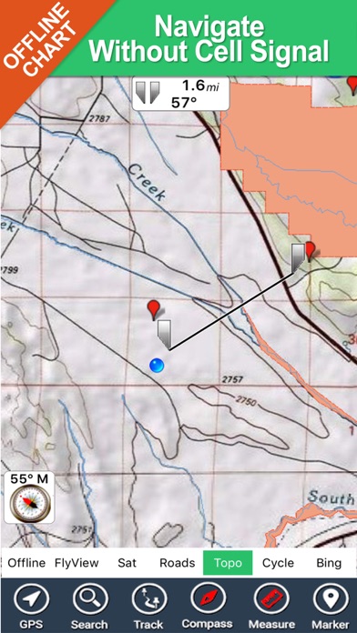
You can Navigate in real time looking your position on the map, you dont need internet connection, switch off the 3G and double your iPhone battery life.
It is a collection of best hunting maps available for Pennsylvania.
- State Game Lands
- State Forest Lands
- State Parks
- the Allegheny National Forest
- the Erie National Wildlife Refuge
- Cooperative Farm-Game Program
- Cooperative Forest-Game Program
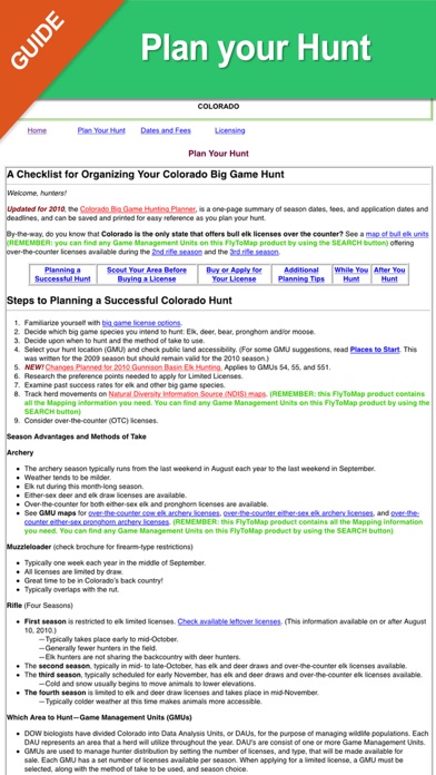
A full hunting guide that you can explore like an internet page, BUT WITHOUT ANY INTERNET CONNECTION:
- Hunting in Pennsylvania general information
- Where to Hunt ?
- Seasons and Limits for each hunting activity
- Laws
- Licensing (License Applications, License Types, License Fees)
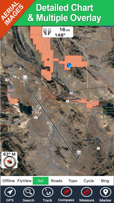
All the above fully integrated in a very detailed topographic map, using the same symbology of the best local hunting paper maps, including:
- Parks and Forests boundaries
- Natural areas boudaries
- Elevation contours (10mt step)
- roads
- trails
- very detailed Mines areas
- rivers and lakes
- Mountain peaks
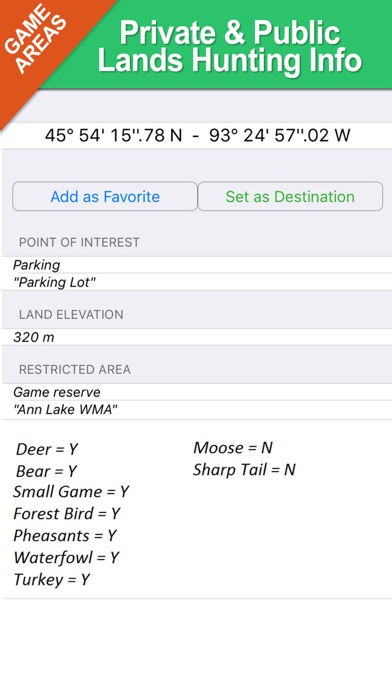
- Point of Interests
Imagine the above mapping data, fully availabe on your iPhone, without the need of any internet connection, used in conjunction with great application functionalities like:
- Shot your favorite picture and store its position on your map. Add a name and comments and retrive it in the future (....shortly you will be also able to share both pictures and position with your friends....)
- Search for any place, including hunting areas, or your favorite spots and retrive them on the map together with your pictures
-Track and store your path.
-Use latitudes and longitudes to go to your favorite places
- See your position on the map in real time, using your iPhone GPS and without any internet connection
- and many others....
Note:
"Continued use of GPS running in the background can dramatically decrease battery life."
"Turn off GPS when not in use"